
The airport is centrally located in the middle of the South Island, within several hours driving distance of Christchurch (284km), Timaru (156km), Oamaru (147km) and Dunedin (260km).
The airport is close to the major inland tourist centres of Queenstown (200km), Wanaka (144km), Mt Cook (70km) and Lake Tekapo (54km). The Omarama area, known for its gliding opportunities, is 32km to the south.
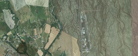
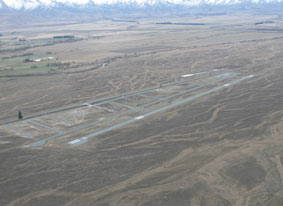
Runway location
| IATA Airport Code | TWZ |
|---|---|
| ICAO Airport Code | NZUK |
| Coordinates | 44°14′13″S 170°7′8″E |
| Latitude | 44 degrees 14 minutes 6 seconds south decimal -44.2350 |
| Longitude | 170 degrees 7 minutes 6 seconds decimal 170.1183 |
| NAVAID | The closest Navigational aid is Mt Mary - VOR-DME 112.5. |